Day 1: The Water Main Hiking Path from Kaiserbrunn to Gloggnitz
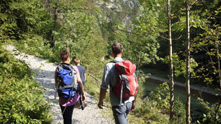
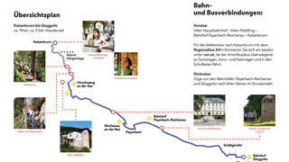
Starting at Kaiserbrunn, the hike follows the impressive landscape of the "alpine climbing trail" through Höllental Valley until reaching Windbrücke Bridge at Hirschwang (one hour and 15 minutes). After crossing the weir on Schwarza River, the hike continues along the federal road through Höllental Valley, parallel to the paper mill.
At the end of the factory complex, leave the federal road by walking left and crossing the bridge. Continue along the mill canal. Later on, the path bifurcates once more to the left and follows the course of the Spring Water Main along Schwarza River.
Walk along the Spring Water Main until reaching Reichenau and follow the Schwarza riverbank promenade. You will then reach Café Nöbauer, where you pass the medieval castle of Reichenau and the church. The spa town of Reichenau is worth a visit above all because of its magnificent villas and the theatre. The Austrian imperial family often spent the summer months here; Arthur Schnitzler, too, used to write in Reichenau.
Near the fork of Barbara Promenade, you can see the model of an aqueduct. Take the Barbara Promenade to Färberbrücke Bridge across Schwarza River near the theatre building. Cross the bridge and immediately turn left towards Fischerpromenade. Continue on this path until reaching the railway viaduct in Payerbach, where the Schwarza is crossed on a footbridge. Then cross the federal road. After approximately 50 metres’ walking along the viaduct, the hiking path turns right into Anton-Weiser-Strasse and again runs parallel to the Spring Water Main. By crossing Bahnhofstrasse, you arrive at Payerbach-Reichenau Railway Station.
The path continues through the village of Payerbach along the course of the Vienna Spring Water Main between the southern railway line and Schwarza River, passing the waterworks superintendent’s house, until you reach Schlöglmühl Railway Station. After this, follow the asphalted left-hand path along the bank of Schwarza River until reaching the passage below the railway tracks. Now walk left of the railway tracks towards Obere Silbersbergstrasse until reaching the pedestrian bridge across the tracks; then continue until you reach Gloggnitz Railway Station, the final point of the hike.
The complete hike takes approximately four hours and 45 minutes.
Free brochure (in German)
Further information
City of Vienna | Vienna Water
Contact form


